
The remainder of our trip will be condensed into a few summarized entries. It's not that we didn't find things to do, but we were satisfied that we had accomplished a decision for next year.
From Yuma, we started a slow, casual trek home, making several stops along the way. We wanted to feel like we were headed home, without racing back and then suffering through potential cold weather. Also, we didn't keep track of specific dates, so this will just be a general summary of the places we stayed.
Out first camping stop was at the Plomosa Road BLM - not the same area near Bouse, but the area directly north of Quartzsite, AZ. This was the area we avoided in January because it is so congested because of all the events in Quartzsite. In March, the campers are widely spaced and very little traffic. We spent a couple of quiet nights here, with a couple of trips into Quartzsite.
After Plomosa Road, we headed to the Lone Tree Dispersed Camping BLM north of Lake Havasu City. This was an easy spot to get into - it looks to be a former gravel mining pit. We decided to stay here and setup camp in the lower area because there was a forecast for high wind in the area. It did get a little congested, as it appeared a number of others were pulling in to avoid the high wind that did blow through as expected. No sense driving the RV in that wind, and risk being blown off the road and/or spending a fortune on the expensive gas. We did make a couple of trips into Lake Havasu City for supplies.

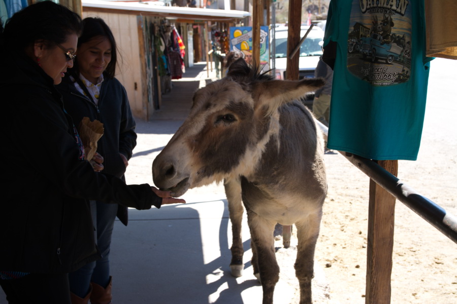
While at Lone Tree, we took a day trip up to Oatman, AZ. Oatman is famous for its wild donkeys that inhabit the area and roam freely in town, waiting for the tourists to provide treats. These donkeys are wild descendants of donkeys abandoned by local miners many years ago. Unfortunately, Oatman didn't live up to the hype, as there was only one donkey in town that roamed up and down the main street and appeared to go where ever it pleased. There was a little entertainment as a local trio of men performed a mock bank robbery and gunfight on main street.
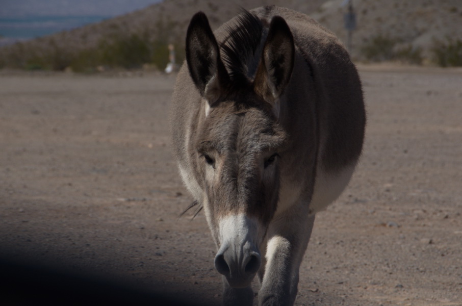
Our best encounters with donkeys appeared outside of town. The first one appeared as we approached Oatman, at the junction of highways 153 and 10. The junction forms a triangle, with the donkey inhabiting the triangle, going from side to side as vehicles approached and stopped.
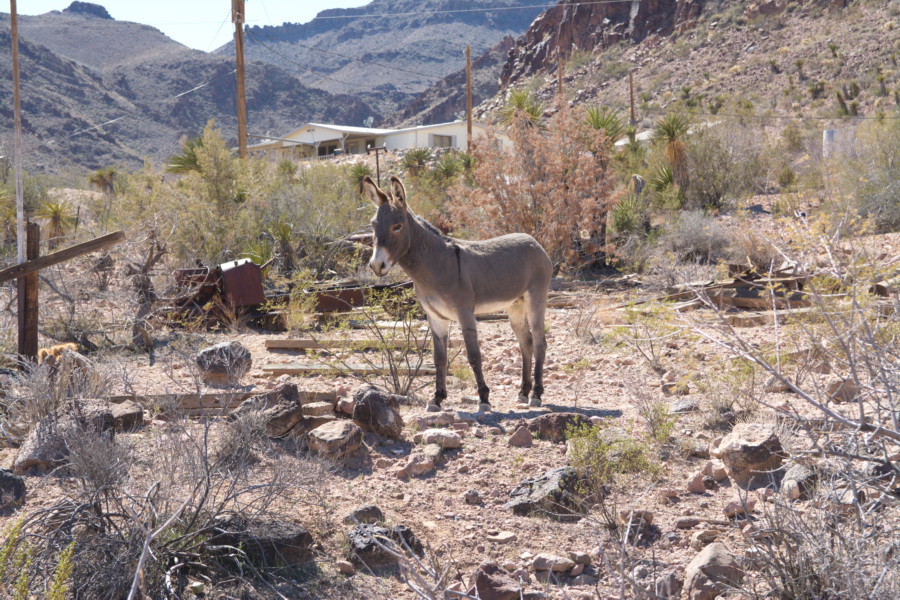
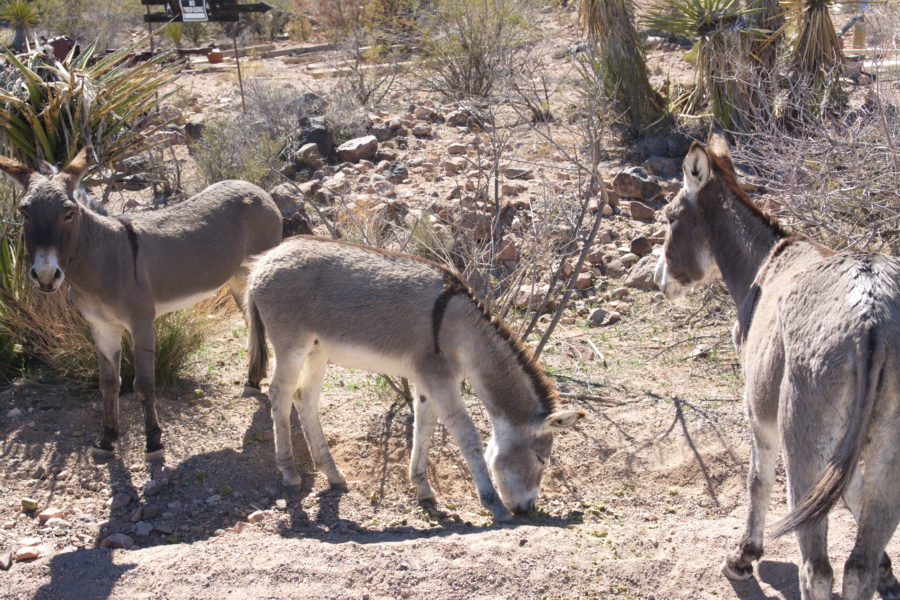
The last encounter was past Oatman, close to Cool Springs Station on highway 10. There were several donkeys on the side of the road. We stopped as we saw another driver feeding them. We got out of the car to watch, and the guy started sharing his stories with us. Apparently he lives nearby, and often comes to feed the donkeys. There were 3 donkeys together, and one off to the side a ways away. We thought the one was afraid of us, but apparently he was more afraid of the larger male that was in the group of 3. The gentlemen explained to us that the large male could be quite aggressive. During one previous encounter, the large male and another got into a fight as a vehicle had stopped to feed them. There was such a fight that they ran into the side of the car, and one donkey had ahold of the other by the neck as they rolled around on the highway. Fortunately one of the area wild life officers happened by, and had to dart both donkeys to end the fight. He also told us a story of a nearby donkey rescue facility that takes in any young orphan donkeys that are found in area. One night a mountain lion got into the compound, and the rescue facility has surveillance camera footage of a couple nearly full grown donkeys beating up the cat. At one point one of the donkeys had the cat by a leg or tail, and was swinging it in circles over its head. Then the video shows them stomping the mountain lion as it lay on the ground.
As the gentleman was relating his stories, we saw the one lone donkey circle the others and approach the road. The alpha donkey made a point of waking toward it, making sure it did not get too close. You could tell he was protecting his food source or maintaining control of the two females with him.
|
|
From there, we headed northeast to Kingman, AZ, grabbed a quick lunch and then drove back to our campsite.
From Lone Tree BLM we headed north and west - as we had booked a site in Death Valley National park for mid-March. Our path took us north to Searchlight, NV, and then west on 164, connecting to Interstate 15. At Baker, CA we turned north until we reached the Silurian Dry Lake Bed BLM. This was a great place to camp - flat, easy to access and our nearest neighbour was at least 1/2 mile away. There was a little highway noise at night, but that was only because we hadn't pulled to far off the road when we pulled in. While we were there we saw vehicles that had parked across the lake bed to the northeast of us. One afternoon we took a trip back to Baker for supplies. Although it is on the interstate, there are very few amenities in Baker except for gas stations.
While at Silurian Lake, we took a drive up toward Death Valley and found a couple of other areas to camp (boondock), and the small town of Tecopa which had zero amenities except a couple of run down looking resorts trying to take advantage of the hot springs in the area.
We took Baxter for a what we thought was a little walk across the dry lake bed. From our motorhome it looked like about 300-400 meters across the dry lake bed to reach the other side. Weren't we surprised to find out it measured about 2 kms across. It was a warm day and we were thankful we took some extra water with us. You can understand how people have been lost in the desert, as distances are certainly much longer than they initially appear.
